
Thank you for supporting this site ❤️
Make a donation
Make a donation
Gear up for your next adventure:
As an Amazon Associate, this site earns from qualifying purchases at no extra cost to you.
Mirwart topographic map
Click on the map to display elevation.
Thank you for supporting this site ❤️
Make a donation
Make a donation
Gear up for your next adventure:
As an Amazon Associate, this site earns from qualifying purchases at no extra cost to you.
About this map
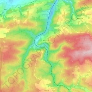
Name: Mirwart topographic map, elevation, terrain.
Location: Mirwart, Saint-Hubert, Neufchâteau, Luxemburg, Wallonië, België (50.03100 5.22916 50.07478 5.33892)
Average elevation: 1,178 ft
Minimum elevation: 748 ft
Maximum elevation: 1,621 ft
Thank you for supporting this site ❤️
Make a donation
Make a donation
Gear up for your next adventure:
As an Amazon Associate, this site earns from qualifying purchases at no extra cost to you.
Other topographic maps
Click on a map to view its topography, its elevation and its terrain.
Région Famenne et Calestienne
België > Luxemburg > Neufchâteau > Saint-Hubert
Average elevation: 1,178 ft