Center Line topographic map
Interactive map
Click on the map to display elevation.
About this map
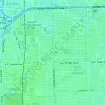
Name: Center Line topographic map, elevation, terrain.
Location: Center Line, Macomb County, Michigan, 48015, United States (42.46868 -83.03886 42.49179 -83.01584)
Average elevation: 630 ft
Minimum elevation: 614 ft
Maximum elevation: 640 ft
Other topographic maps
Click on a map to view its topography, its elevation and its terrain.
Armada
United States > Michigan > Macomb County
Armada, Macomb County, Michigan, United States
Average elevation: 748 ft
Van Dyke
United States > Michigan > Macomb County > Warren
Van Dyke, Warren, Macomb County, Michigan, 48015, United States
Average elevation: 630 ft
Sterling Heights
United States > Michigan > Macomb County
Sterling Heights, Macomb County, Michigan, United States
Average elevation: 627 ft
Saint Clair Shores
United States > Michigan > Macomb County
Saint Clair Shores, Macomb County, Michigan, United States
Average elevation: 587 ft
Harrison Charter Township
United States > Michigan > Macomb County
Harrison Charter Township, Macomb County, Michigan, United States
Average elevation: 581 ft
Shelby Charter Township
United States > Michigan > Macomb County
Shelby Charter Township, Macomb County, Michigan, United States
Average elevation: 673 ft
Washington Charter Township
United States > Michigan > Macomb County
Washington Charter Township, Macomb County, Michigan, 48095, United States
Average elevation: 787 ft
Sterling Heights
United States > Michigan > Macomb County > Sterling Heights > Sterling Heights
Sterling Heights, Macomb County, Michigan, 48313-4615, United States
Average elevation: 673 ft
Macomb Township
United States > Michigan > Macomb County
Macomb Township, Macomb County, Michigan, United States
Average elevation: 620 ft
Shelby Charter Township
United States > Michigan > Macomb County > Shelby Charter Township
Shelby Charter Township, Macomb County, Michigan, 48094, United States
Average elevation: 673 ft