Geolocate

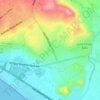
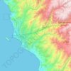
El Rosedal topographic map

Click on the map to display elevation.

About this map

Name: El Rosedal topographic map, elevation, terrain.

Location: El Rosedal, Miraflores, Lima, Lima Metropolitana, Lima, Perú, Parque Cesar Vallejo (-12.12606 -77.01698 -12.12567 -77.01609)

Average elevation: 315 ft

Minimum elevation: 0 ft

Maximum elevation: 433 ft

Other topographic maps

Click on a map to view its topography, its elevation and its terrain.
Circuito El Prado

Perú > Lima > Lima Metropolitana

Average elevation: 1,191 ft

Santa Anita

Perú > Lima > Lima Metropolitana

Average elevation: 433 ft

Chocas Alto

Perú > Lima > Lima Metropolitana

Average elevation: 2,093 ft

La Unión

Perú > Lima > Lima Metropolitana

Average elevation: 184 ft

Parque de la Reserva

Perú > Lima > Lima Metropolitana

Average elevation: 440 ft

El Volante II

Perú > Lima > Lima Metropolitana

Average elevation: 722 ft

Lima

Perú > Lima > Lima Metropolitana

Average elevation: 4,049 ft

Manchay Bajo

Perú > Lima > Lima Metropolitana

Average elevation: 787 ft

Manchay Alto

Perú > Lima > Lima Metropolitana > Nuevo Progreso

Average elevation: 719 ft

Rumi Wasi

Perú > Lima > Lima Metropolitana

Average elevation: 899 ft

Gear up for your next adventure:

📶Satellite Messenger - Communication device off‑grid
🪶Trail Camera - Capture wildlife on your hikes
🕶️Glacier Sunglasses - Side shields to protect eyes from high-altitude snow glare
⛺Backpacking Tents - Weight-optimized shelters for multi-day topographic surveys
⌚GPS Sports Watch - GPS watch for running, hiking and training

As an Amazon Associate, this site earns from qualifying purchases at no extra cost to you.