
Thank you for supporting this site ❤️
Make a donation
Make a donation
Gear up for your next adventure:
As an Amazon Associate, this site earns from qualifying purchases at no extra cost to you.
Mazamitla topographic map
Click on the map to display elevation.
Thank you for supporting this site ❤️
Make a donation
Make a donation
Gear up for your next adventure:
As an Amazon Associate, this site earns from qualifying purchases at no extra cost to you.
About this map
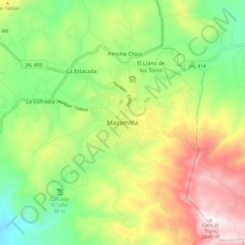
Name: Mazamitla topographic map, elevation, terrain.
Location: Mazamitla, Jalisco, 49540, Mexico (19.87635 -103.06000 19.95635 -102.98000)
Average elevation: 7,287 ft
Minimum elevation: 5,853 ft
Maximum elevation: 9,304 ft
Thank you for supporting this site ❤️
Make a donation
Make a donation
Gear up for your next adventure:
As an Amazon Associate, this site earns from qualifying purchases at no extra cost to you.