
Thank you for supporting this site ❤️
Make a donation
Make a donation
Gear up for your next adventure:
As an Amazon Associate, this site earns from qualifying purchases at no extra cost to you.
Targyailing topographic map
Click on the map to display elevation.
Thank you for supporting this site ❤️
Make a donation
Make a donation
Gear up for your next adventure:
As an Amazon Associate, this site earns from qualifying purchases at no extra cost to you.
About this map
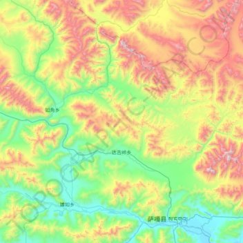
Name: Targyailing topographic map, elevation, terrain.
Location: Targyailing, Saga County, Shigatse Prefecture, Tibet, China (29.40073 84.85143 29.72910 85.52532)
Average elevation: 16,673 ft
Minimum elevation: 14,633 ft
Maximum elevation: 20,781 ft
Thank you for supporting this site ❤️
Make a donation
Make a donation
Gear up for your next adventure:
As an Amazon Associate, this site earns from qualifying purchases at no extra cost to you.