Geolocate

Aru topographic map

Interactive map

Click on the map to display elevation.

About this map

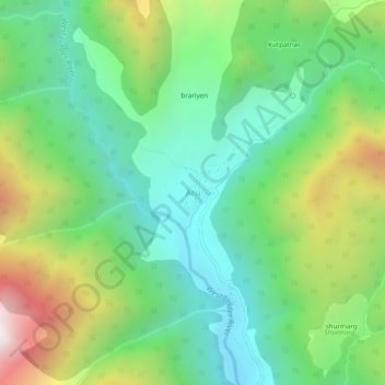
Name: Aru topographic map, elevation, terrain.

Location: Aru, Pahalgam, Anantnag District, Jammu and Kashmir, India (34.07030 75.24244 34.11030 75.28244)

Average elevation: 9,068 ft

Minimum elevation: 7,562 ft

Maximum elevation: 12,110 ft

Other topographic maps

Click on a map to view its topography, its elevation and its terrain.

lidru

India > Jammu and Kashmir > Pahalgam

lidru, Pahalgam, Anantnag District, Jammu and Kashmir, India

Average elevation: 7,867 ft

kolur

India > Jammu and Kashmir > Pahalgam

kolur, Pahalgam, Anantnag District, Jammu and Kashmir, India

Average elevation: 6,617 ft

Panchtarni

India > Jammu and Kashmir > Pahalgam

Panchtarni, Pahalgam, Anantnag District, Jammu and Kashmir, India

Average elevation: 12,792 ft