Geolocate

Pusil topographic map

Click on the map to display elevation.

About this map

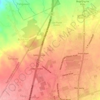
Name: Pusil topographic map, elevation, terrain.

Location: Pusil, Lipa, Batangas, Calabarzon, 4127, Philippines (13.95953 121.13404 13.99953 121.17404)

Average elevation: 1,106 ft

Minimum elevation: 846 ft

Maximum elevation: 1,227 ft

Other topographic maps

Click on a map to view its topography, its elevation and its terrain.

Duhatan

Philippines > Batangas > Lipa

Average elevation: 978 ft

Gear up for your next adventure:

🦺Reflective Outdoor Gear - Safety gear for low‑light conditions
🎒Trekking Poles - Sturdy poles for balance and stability on rough terrain
🪶Trail Camera - Capture wildlife on your hikes
📡Handheld GPS Device - Reliable handheld GPS for outdoor navigation
🛰️Satellite Messengers - Emergency SOS and two-way messaging for off-grid adventures

As an Amazon Associate, this site earns from qualifying purchases at no extra cost to you.