
Thank you for supporting this site ❤️
Make a donation
Make a donation
Gear up for your next adventure:
As an Amazon Associate, this site earns from qualifying purchases at no extra cost to you.
温泉 topographic map
Click on the map to display elevation.
Thank you for supporting this site ❤️
Make a donation
Make a donation
Gear up for your next adventure:
As an Amazon Associate, this site earns from qualifying purchases at no extra cost to you.
About this map
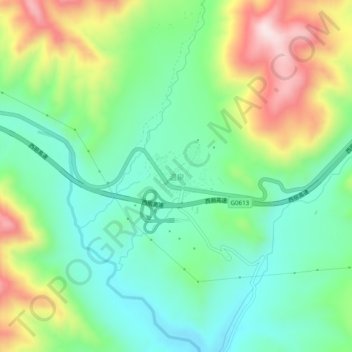
Name: 温泉 topographic map, elevation, terrain.
Location: 温泉, 兴海县, 海南藏族自治州, 青海省, 中国 (35.38484 99.41440 35.42484 99.45440)
Average elevation: 13,159 ft
Minimum elevation: 12,667 ft
Maximum elevation: 14,111 ft
Thank you for supporting this site ❤️
Make a donation
Make a donation
Gear up for your next adventure:
As an Amazon Associate, this site earns from qualifying purchases at no extra cost to you.
Other topographic maps
Click on a map to view its topography, its elevation and its terrain.