
Bretnig topographic map
Interactive map
Click on the map to display elevation.
About this map
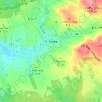
Name: Bretnig topographic map, elevation, terrain.
Average elevation: 1,004 ft
Minimum elevation: 889 ft
Maximum elevation: 1,184 ft
Other topographic maps
Click on a map to view its topography, its elevation and its terrain.
Bretnig-Hauswalde
Germany > Saxony > Großröhrsdorf
Bretnig-Hauswalde, Großröhrsdorf, Bautzen, Saxony, Germany
Average elevation: 1,040 ft