
Thank you for supporting this site ❤️
Make a donation
Make a donation
Gear up for your next adventure:
As an Amazon Associate, this site earns from qualifying purchases at no extra cost to you.
Yarmuqam topographic map
Click on the map to display elevation.
Thank you for supporting this site ❤️
Make a donation
Make a donation
Gear up for your next adventure:
As an Amazon Associate, this site earns from qualifying purchases at no extra cost to you.
About this map
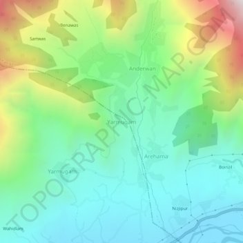
Name: Yarmuqam topographic map, elevation, terrain.
Location: Yarmuqam, Lar, Ganderbal District, Jammu and Kashmir, India (34.28416 74.79034 34.32416 74.83034)
Average elevation: 6,975 ft
Minimum elevation: 5,522 ft
Maximum elevation: 10,456 ft
Thank you for supporting this site ❤️
Make a donation
Make a donation
Gear up for your next adventure:
As an Amazon Associate, this site earns from qualifying purchases at no extra cost to you.