Geolocate

La Faure topographic map

Click on the map to display elevation.

About this map
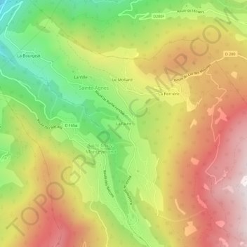
Name: La Faure topographic map, elevation, terrain.

Location: La Faure, Sainte-Agnès, Grenoble, Isère, Auvergne-Rhône-Alpes, France métropolitaine, 38190, France (45.21022 5.91206 45.25022 5.95206)

Average elevation: 2,920 ft

Minimum elevation: 1,004 ft

Maximum elevation: 4,734 ft

Other topographic maps

Click on a map to view its topography, its elevation and its terrain.

Lac Blanc

France > Auvergne-Rhône-Alpes > Isère > Sainte-Agnès

Average elevation: 7,684 ft

Gear up for your next adventure:

👟Trail Running Shoes - Lightweight shoes for trail runners
🏕️Tent Footprint - Protect your tent base from wear
🧣Hiking Neck Gaiter - Multi‑use neck protection for outdoor weather
🧭GPS Watch Accessories - Bands and chargers for GPS watches
🧯Emergency Survival Kit - All‑in‑one survival essentials for the backcountry

As an Amazon Associate, this site earns from qualifying purchases at no extra cost to you.