
Lac Lola topographic map
Interactive map
Click on the map to display elevation.
About this map
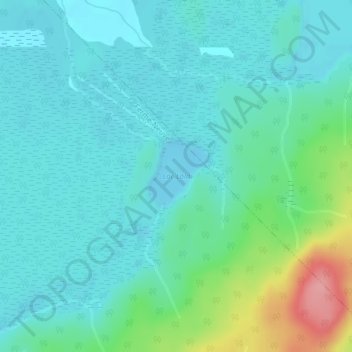
Name: Lac Lola topographic map, elevation, terrain.
Average elevation: 843 ft
Minimum elevation: 768 ft
Maximum elevation: 1,129 ft
Other topographic maps
Click on a map to view its topography, its elevation and its terrain.
Ferme-Neuve
Canada > Quebec > Ferme-Neuve
Ferme-Neuve, Antoine-Labelle, Laurentides, Quebec, J0W 1C0, Canada
Average elevation: 1,004 ft
Branche Papineau
Canada > Quebec > Ferme-Neuve
Branche Papineau, Ferme-Neuve, Antoine-Labelle, Laurentides, Quebec, Canada
Average elevation: 1,047 ft