
Saint-Marcel topographic map
Click on the map to display elevation.
About this map
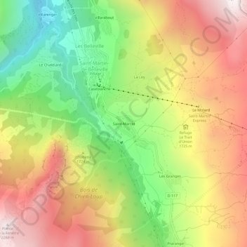
Name: Saint-Marcel topographic map, elevation, terrain.
Average elevation: 5,551 ft
Minimum elevation: 3,642 ft
Maximum elevation: 7,451 ft
Other topographic maps
Click on a map to view its topography, its elevation and its terrain.
Lac Crintallia
France > Auvergne-Rhône-Alpes > Savoie > Saint-Martin-de-Belleville
Average elevation: 7,638 ft
Glacier de Péclet
France > Auvergne-Rhône-Alpes > Savoie > Saint-Martin-de-Belleville
Average elevation: 9,829 ft
Glacier de Thorens
France > Auvergne-Rhône-Alpes > Savoie > Saint-Martin-de-Belleville
Average elevation: 9,797 ft
Lac du Lou
France > Auvergne-Rhône-Alpes > Savoie > Saint-Martin-de-Belleville
Average elevation: 7,513 ft