
Thank you for supporting this site ❤️
Make a donation
Make a donation
Gear up for your next adventure:
As an Amazon Associate, this site earns from qualifying purchases at no extra cost to you.
Steinbach topographic map
Click on the map to display elevation.
Thank you for supporting this site ❤️
Make a donation
Make a donation
Gear up for your next adventure:
As an Amazon Associate, this site earns from qualifying purchases at no extra cost to you.
About this map
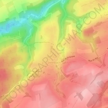
Name: Steinbach topographic map, elevation, terrain.
Location: Steinbach, Gouvy, Bastogne, Luxembourg, Wallonie, 6670, Belgique (50.13824 5.89463 50.15584 5.91423)
Average elevation: 1,562 ft
Minimum elevation: 1,247 ft
Maximum elevation: 1,729 ft
Thank you for supporting this site ❤️
Make a donation
Make a donation
Gear up for your next adventure:
As an Amazon Associate, this site earns from qualifying purchases at no extra cost to you.