
Thank you for supporting this site ❤️
Make a donation
Make a donation
Gear up for your next adventure:
As an Amazon Associate, this site earns from qualifying purchases at no extra cost to you.
Buerán topographic map
Click on the map to display elevation.
Thank you for supporting this site ❤️
Make a donation
Make a donation
Gear up for your next adventure:
As an Amazon Associate, this site earns from qualifying purchases at no extra cost to you.
About this map
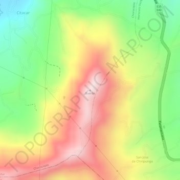
Name: Buerán topographic map, elevation, terrain.
Location: Buerán, Chorocopte, Cañar, 030201, Ecuador (-2.59944 -78.92882 -2.59934 -78.92872)
Average elevation: 11,791 ft
Minimum elevation: 11,027 ft
Maximum elevation: 12,487 ft
Thank you for supporting this site ❤️
Make a donation
Make a donation
Gear up for your next adventure:
As an Amazon Associate, this site earns from qualifying purchases at no extra cost to you.