Geolocate

Spanish Town topographic map

Click on the map to display elevation.

About this map

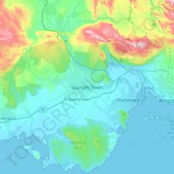
Name: Spanish Town topographic map, elevation, terrain.

Location: Spanish Town, Saint Catherine, Middlesex County, Jamaica (17.83569 -77.11408 18.15569 -76.79408)

Average elevation: 446 ft

Minimum elevation: -10 ft

Maximum elevation: 2,500 ft

Other topographic maps

Click on a map to view its topography, its elevation and its terrain.

Portmore

Jamaica > Saint Catherine

Average elevation: 39 ft

Portmore

Jamaica > Saint Catherine

Average elevation: 39 ft

Gear up for your next adventure:

📱Solar Portable Charger - Solar power bank for charging devices off‑grid
🗺️NatGeo Topo Maps - High-quality waterproof printed topographic maps of US Parks
🔦Compact Flashlight - Reliable flashlight for emergencies
😴Insulated Sleeping Pads - Compact and warm pads for high-elevation camping
🔪Outdoor Multitools - Essential survival tools for gear repair and field use

As an Amazon Associate, this site earns from qualifying purchases at no extra cost to you.