
Thank you for supporting this site ❤️
Make a donation
Make a donation
Gear up for your next adventure:
As an Amazon Associate, this site earns from qualifying purchases at no extra cost to you.
Upper Yubeng topographic map
Click on the map to display elevation.
Thank you for supporting this site ❤️
Make a donation
Make a donation
Gear up for your next adventure:
As an Amazon Associate, this site earns from qualifying purchases at no extra cost to you.
About this map
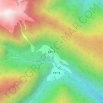
Name: Upper Yubeng topographic map, elevation, terrain.
Location: Upper Yubeng, Yunling, Dêqên County, Diqing, Yunnan, China (28.38062 98.77129 28.42062 98.81129)
Average elevation: 11,680 ft
Minimum elevation: 9,344 ft
Maximum elevation: 14,770 ft
Thank you for supporting this site ❤️
Make a donation
Make a donation
Gear up for your next adventure:
As an Amazon Associate, this site earns from qualifying purchases at no extra cost to you.