Geolocate

Burlington topographic map

Click on the map to display elevation.

About this map

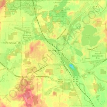
Name: Burlington topographic map, elevation, terrain.

Location: Burlington, Racine County, Wisconsin, 53105, United States (42.63920 -88.31840 42.71249 -88.22604)

Average elevation: 784 ft

Minimum elevation: 640 ft

Maximum elevation: 912 ft

Racine County trails, hiking, mountain biking, running and outdoor activities

Other topographic maps

Click on a map to view its topography, its elevation and its terrain.

Franksville

United States > Wisconsin > Racine County > Caledonia

Average elevation: 741 ft

Gear up for your next adventure:

🕶️Glacier Sunglasses - Side shields to protect eyes from high-altitude snow glare
🪶Fire Starter Kit - Reliable fire starter for survival and camping
🚁Photography Drones - Capture stunning aerial views of landforms and topography
🕶️GPS Smartphone Mount - Secure mount for phone navigation
🌐World Map Poster - Decorative world maps with topographic info

As an Amazon Associate, this site earns from qualifying purchases at no extra cost to you.