Geolocate

Sonadora topographic map

Click on the map to display elevation.

About this map

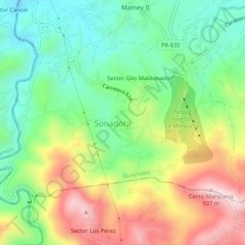
Name: Sonadora topographic map, elevation, terrain.

Location: Sonadora, Guaynabo, Puerto Rico, United States (18.27771 -66.14410 18.30040 -66.10819)

Average elevation: 758 ft

Minimum elevation: 187 ft

Maximum elevation: 1,627 ft

Puerto Rico trails, hiking, mountain biking, running and outdoor activities

Gear up for your next adventure:

🥤Water Filter Bottle - All‑in‑one filter bottle for safe hydration
🧣Merino Neck Gaiters - Multi-functional headwear for wind and sun protection
🌲Outdoor Survival Books - Best books on survival skills
📶Vehicle Signal Boosters - Improve reception in rural areas while driving to trailheads
🧤Tactile Hiking Gloves - Keep hands warm while operating GPS and smartphone screens

As an Amazon Associate, this site earns from qualifying purchases at no extra cost to you.