
Auchi topographic map
Click on the map to display elevation.
Auchi
The climate at Auchi, which has an elevation of 0 meters (None feet) above sea level, is tropical wet and dry or savanna (Aw classification). The district's average annual temperature is -0.74% lower than Nigeria's averages at 28.72 °C (83.7 °F). 183.14 millimeters (7.21 inches) of precipitation and 265.4 rainy days (72.71% of the time) are typical yearly totals for Auchi.
About this map
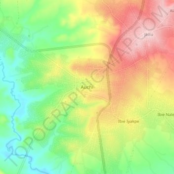
Name: Auchi topographic map, elevation, terrain.
Location: Auchi, Etsako West, Edo State, Nigeria (7.02745 6.22767 7.10745 6.30767)
Average elevation: 610 ft
Minimum elevation: 266 ft
Maximum elevation: 1,043 ft