Geolocate

Ponmar topographic map

Click on the map to display elevation.

About this map

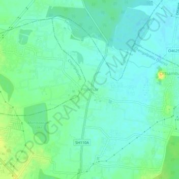
Name: Ponmar topographic map, elevation, terrain.

Location: Ponmar, Tiruporur, Chengalpattu, Tamil Nadu, 600127, India (12.83748 80.15194 12.87748 80.19194)

Average elevation: 36 ft

Minimum elevation: 10 ft

Maximum elevation: 85 ft

Gear up for your next adventure:

🎒Waterproof Dry Bags - Keep your electronics and maps dry inside your pack
🧦Merino Wool Socks - Moisture-wicking, blister-preventing socks for long treks
🗺️Topographic Maps - Detailed topo maps for hiking, exploring and outdoor navigation
🌡️Portable Weather Meter - Track weather conditions on the trail
🪶Survival Guide Book - Expert advice for emergency preparedness

As an Amazon Associate, this site earns from qualifying purchases at no extra cost to you.