
Thank you for supporting this site ❤️
Make a donation
Make a donation
Gear up for your next adventure:
As an Amazon Associate, this site earns from qualifying purchases at no extra cost to you.
Shyok River topographic map
Click on the map to display elevation.
Thank you for supporting this site ❤️
Make a donation
Make a donation
Gear up for your next adventure:
As an Amazon Associate, this site earns from qualifying purchases at no extra cost to you.
About this map
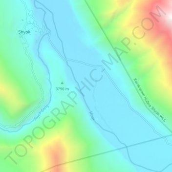
Name: Shyok River topographic map, elevation, terrain.
Location: Shyok River, Shyok, Leh District, Ladakh, India (34.12646 78.14469 34.18976 78.20608)
Average elevation: 13,166 ft
Minimum elevation: 11,673 ft
Maximum elevation: 18,839 ft
Thank you for supporting this site ❤️
Make a donation
Make a donation
Gear up for your next adventure:
As an Amazon Associate, this site earns from qualifying purchases at no extra cost to you.