Geolocate

Schofield topographic map

Click on the map to display elevation.

About this map

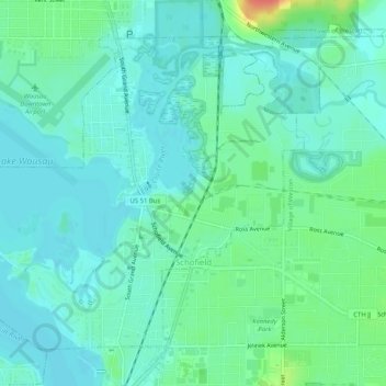
Name: Schofield topographic map, elevation, terrain.

Location: Schofield, Marathon County, Wisconsin, United States (44.90147 -89.64112 44.93086 -89.58990)

Average elevation: 1,194 ft

Minimum elevation: 1,152 ft

Maximum elevation: 1,329 ft

Wisconsin trails, hiking, mountain biking, running and outdoor activities

Gear up for your next adventure:

🪶Wildlife Field Guides - Learn animal tracking and species ID
📚Navigation Handbooks - Master the art of reading topographic maps and using a compass
🪶Paracord Bracelet - Survival bracelet with built‑in tools
GPS Sports Watch - GPS watch for running, hiking and training
🪶Multi‑Purpose Knife - Useful blade for camp and trail

As an Amazon Associate, this site earns from qualifying purchases at no extra cost to you.