
Thank you for supporting this site ❤️
Make a donation
Make a donation
Gear up for your next adventure:
As an Amazon Associate, this site earns from qualifying purchases at no extra cost to you.
Básar topographic map
Click on the map to display elevation.
Thank you for supporting this site ❤️
Make a donation
Make a donation
Gear up for your next adventure:
As an Amazon Associate, this site earns from qualifying purchases at no extra cost to you.
About this map
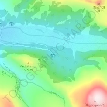
Name: Básar topographic map, elevation, terrain.
Location: Básar, Rangárþing eystra, Suðurland, Islande (63.66772 -19.49183 63.68772 -19.47183)
Average elevation: 1,161 ft
Minimum elevation: 709 ft
Maximum elevation: 2,510 ft
Thank you for supporting this site ❤️
Make a donation
Make a donation
Gear up for your next adventure:
As an Amazon Associate, this site earns from qualifying purchases at no extra cost to you.