
Thank you for supporting this site ❤️
Make a donation
Make a donation
Gear up for your next adventure:
As an Amazon Associate, this site earns from qualifying purchases at no extra cost to you.
Ada topographic map
Click on the map to display elevation.
Thank you for supporting this site ❤️
Make a donation
Make a donation
Gear up for your next adventure:
As an Amazon Associate, this site earns from qualifying purchases at no extra cost to you.
About this map
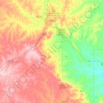
Name: Ada topographic map, elevation, terrain.
Location: Ada, Pontotoc County, Oklahoma, 74820, United States (34.50593 -96.75747 34.84013 -96.56378)
Average elevation: 984 ft
Minimum elevation: 633 ft
Maximum elevation: 1,335 ft
Pontotoc County trails, hiking, mountain biking, running and outdoor activities
Thank you for supporting this site ❤️
Make a donation
Make a donation
Gear up for your next adventure:
As an Amazon Associate, this site earns from qualifying purchases at no extra cost to you.