Geolocate

Ísafjörður topographic map

Click on the map to display elevation.

About this map

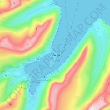
Name: Ísafjörður topographic map, elevation, terrain.

Location: Ísafjörður, Ísafjarðarbær, Westfjords Region, 400, Iceland (66.03269 -23.15935 66.11269 -23.07935)

Average elevation: 778 ft

Minimum elevation: -20 ft

Maximum elevation: 2,684 ft

Gear up for your next adventure:

📦Dry Bags Set - Waterproof storage for electronics and clothes
📚Navigation Handbooks - Master the art of reading topographic maps and using a compass
🧦Merino Wool Socks - Moisture-wicking, blister-preventing socks for long treks
❄️Traction Cleats - Prevent slips on icy trails during winter hikes
🦺Reflective Outdoor Gear - Safety gear for low‑light conditions

As an Amazon Associate, this site earns from qualifying purchases at no extra cost to you.