
Thank you for supporting this site ❤️
Make a donation
Make a donation
Gear up for your next adventure:
As an Amazon Associate, this site earns from qualifying purchases at no extra cost to you.
Auma-Weidatal topographic map
Click on the map to display elevation.
Thank you for supporting this site ❤️
Make a donation
Make a donation
Gear up for your next adventure:
As an Amazon Associate, this site earns from qualifying purchases at no extra cost to you.
About this map
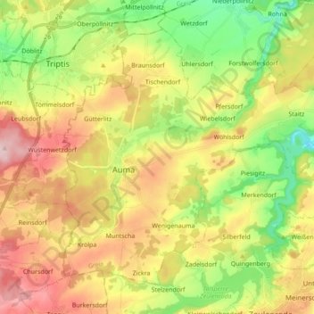
Name: Auma-Weidatal topographic map, elevation, terrain.
Location: Auma-Weidatal, Greiz, Thuringia, 07955, Germany (50.65881 11.86605 50.74727 12.03714)
Average elevation: 1,289 ft
Minimum elevation: 942 ft
Maximum elevation: 1,693 ft
Thank you for supporting this site ❤️
Make a donation
Make a donation
Gear up for your next adventure:
As an Amazon Associate, this site earns from qualifying purchases at no extra cost to you.