Geolocate

Noway topographic map

Click on the map to display elevation.

About this map

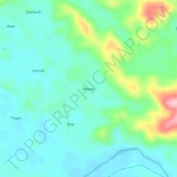
Name: Noway topographic map, elevation, terrain.

Location: Noway, St. John River City, Grand Bassa County, Liberia (6.04238 -9.93713 6.08238 -9.89713)

Average elevation: 266 ft

Minimum elevation: 112 ft

Maximum elevation: 755 ft

Gear up for your next adventure:

🛠️Outdoor Gear Repair Kit - Essential tools to fix gear on the trail
🧭Pro Hiking Compasses - High-accuracy liquid-filled compasses for topographic orientation
🎒Outdoor Daypacks - Lightweight backpacks designed for carrying maps and essential gear
💧Water Purification System - Clean water on the trail with reliable purifiers
🗃️Trail First Aid Kit - Essential kit for outdoor injuries and emergencies

As an Amazon Associate, this site earns from qualifying purchases at no extra cost to you.