Geolocate

Huascaran topographic map

Click on the map to display elevation.

About this map

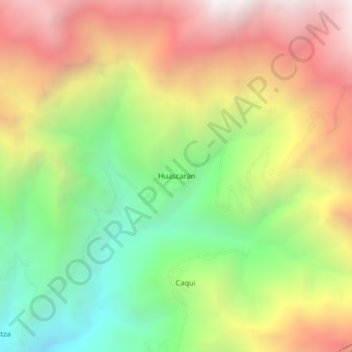
Name: Huascaran topographic map, elevation, terrain.

Location: Huascaran, Quillo, Yungay, Áncash, Perú (-9.42659 -78.00661 -9.38659 -77.96661)

Average elevation: 8,294 ft

Minimum elevation: 5,039 ft

Maximum elevation: 11,909 ft

Gear up for your next adventure:

🔊Portable Camp Speaker - Music and alerts at camp
🥇GPS Hiking Watch - Multi‑sport GPS watch with navigation and trail tracking
🔦Compact Flashlight - Reliable flashlight for emergencies
🎒Outdoor Daypacks - Lightweight backpacks designed for carrying maps and essential gear
🎁Geography Themed Gifts - Unique gift ideas for map lovers and geography enthusiasts

As an Amazon Associate, this site earns from qualifying purchases at no extra cost to you.