
Dras topographic map
Click on the map to display elevation.
Dras
Dras (also spelt Drass, ISO transliteration: Drās), also known locally in Shina as Himababs, Hembabs, or Humas, is a town and hill station, near Kargil in the Kargil district of the union territory of Ladakh in India. It is on the NH 1 between Zoji La pass and Kargil. A tourist hub for its high-altitude trekking routes and tourist sites, it is often called "The Gateway to Ladakh". The government's official spelling of the town's name is "Drass".
About this map
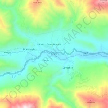
Name: Dras topographic map, elevation, terrain.
Location: Dras, Drass, Kargil district, Ladakh, India (34.38927 75.71076 34.46927 75.79076)
Average elevation: 11,585 ft
Minimum elevation: 9,990 ft
Maximum elevation: 15,443 ft