Geolocate

Kothur topographic map

Click on the map to display elevation.

About this map

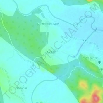
Name: Kothur topographic map, elevation, terrain.

Location: Kothur, Tadvai mandal, Mulugu, Telangana, India (18.30304 80.19809 18.34304 80.23809)

Average elevation: 413 ft

Minimum elevation: 364 ft

Maximum elevation: 663 ft

Gear up for your next adventure:

🥤Water Filter Bottle - All‑in‑one filter bottle for safe hydration
🎒Gear Packing Cubes - Organize your backpack efficiently
🪵Folding Camp Saw - Compact saw for wood and campsite work
🧣Hiking Neck Gaiter - Multi‑use neck protection for outdoor weather
🥄Camping Utensil Set - Lightweight utensils for outdoor meals

As an Amazon Associate, this site earns from qualifying purchases at no extra cost to you.