
Make a donation
Gear up for your next adventure:
As an Amazon Associate, this site earns from qualifying purchases at no extra cost to you.
Chakulia topographic map
Click on the map to display elevation.
Make a donation
Gear up for your next adventure:
As an Amazon Associate, this site earns from qualifying purchases at no extra cost to you.
Chakulia
Chakulia is located at 22°29′N 86°43′E / 22.48°N 86.72°E / 22.48; 86.72. It has an average elevation of 115 metres (377 feet).
Make a donation
Gear up for your next adventure:
As an Amazon Associate, this site earns from qualifying purchases at no extra cost to you.
About this map
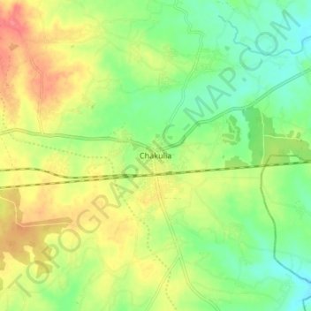
Name: Chakulia topographic map, elevation, terrain.
Location: Chakulia, East Singhbhum, Jharkhand, 832300, India (22.44301 86.67793 22.52301 86.75793)
Average elevation: 390 ft
Minimum elevation: 299 ft
Maximum elevation: 502 ft
Make a donation
Gear up for your next adventure:
As an Amazon Associate, this site earns from qualifying purchases at no extra cost to you.