
Make a donation
Gear up for your next adventure:
As an Amazon Associate, this site earns from qualifying purchases at no extra cost to you.
Gorgan topographic map
Click on the map to display elevation.
Make a donation
Gear up for your next adventure:
As an Amazon Associate, this site earns from qualifying purchases at no extra cost to you.
Gorgan
Gorgan has a subtropical mediterranean climate (Köppen: Csa, Trewartha: Cs), with hot, humid summers and cool, wet winters. In general, Golestan has a moderate and humid climate known as "the moderate Caspian climate". The effective factors behind such a climate are Alborz mountain range, the direction of the mountains, the height of the area, the neighborhood to the sea, vegetation surface, local winds, altitude, and weather fronts. As a result of the above factors, three different climates exist in the region: plain moderate, mountainous, and semi-arid. Gorgan valley has a semi-arid climate. The average annual temperature is 17.8 °C (64.0 °F).
Make a donation
Gear up for your next adventure:
As an Amazon Associate, this site earns from qualifying purchases at no extra cost to you.
About this map
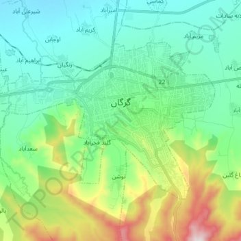
Name: Gorgan topographic map, elevation, terrain.
Location: Gorgan, بخش مرکزی, Gorgan County, Golestan Province, Iran (36.79485 54.34893 36.86619 54.48563)
Average elevation: 597 ft
Minimum elevation: 3 ft
Maximum elevation: 2,356 ft
Make a donation
Gear up for your next adventure:
As an Amazon Associate, this site earns from qualifying purchases at no extra cost to you.