
Thank you for supporting this site ❤️
Make a donation
Make a donation
Gear up for your next adventure:
As an Amazon Associate, this site earns from qualifying purchases at no extra cost to you.
Chingola topographic map
Click on the map to display elevation.
Thank you for supporting this site ❤️
Make a donation
Make a donation
Gear up for your next adventure:
As an Amazon Associate, this site earns from qualifying purchases at no extra cost to you.
About this map
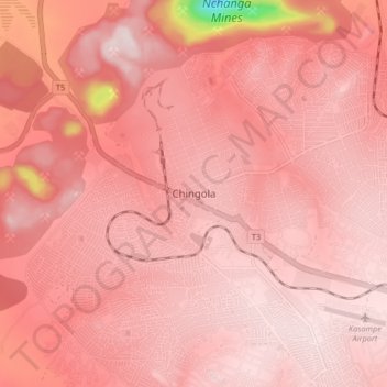
Name: Chingola topographic map, elevation, terrain.
Location: Chingola, Chingola District, Copperbelt Province, Zambia (-12.58749 27.82004 -12.50749 27.90004)
Average elevation: 4,429 ft
Minimum elevation: 3,169 ft
Maximum elevation: 4,682 ft
Thank you for supporting this site ❤️
Make a donation
Make a donation
Gear up for your next adventure:
As an Amazon Associate, this site earns from qualifying purchases at no extra cost to you.