
Goilala District topographic map
Click on the map to display elevation.
About this map
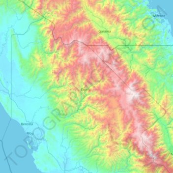
Name: Goilala District topographic map, elevation, terrain.
Location: Goilala District, Central, Southern Region, Papua New Guinea (-9.03333 146.30000 -7.63333 147.70000)
Average elevation: 3,261 ft
Minimum elevation: -3 ft
Maximum elevation: 12,979 ft
Other topographic maps
Click on a map to view its topography, its elevation and its terrain.