
Thank you for supporting this site ❤️
Make a donation
Make a donation
Gear up for your next adventure:
As an Amazon Associate, this site earns from qualifying purchases at no extra cost to you.
Mbagala Kuu topographic map
Click on the map to display elevation.
Thank you for supporting this site ❤️
Make a donation
Make a donation
Gear up for your next adventure:
As an Amazon Associate, this site earns from qualifying purchases at no extra cost to you.
About this map
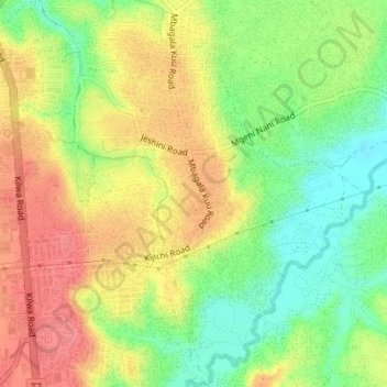
Name: Mbagala Kuu topographic map, elevation, terrain.
Location: Mbagala Kuu, Temeke MC, Dar es-Salaam, Coastal Zone, Tanzania (-6.92582 39.26726 -6.89143 39.30072)
Average elevation: 125 ft
Minimum elevation: 7 ft
Maximum elevation: 230 ft
Thank you for supporting this site ❤️
Make a donation
Make a donation
Gear up for your next adventure:
As an Amazon Associate, this site earns from qualifying purchases at no extra cost to you.
Other topographic maps
Click on a map to view its topography, its elevation and its terrain.