Geolocate

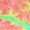
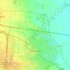
Ivankiv topographic map

Click on the map to display elevation.

About this map

Name: Ivankiv topographic map, elevation, terrain.

Location: Ivankiv, Ivankiv Settlement Hromada, Vyshhorod Raion, Kyiv Oblast, 07200, Ukraine (50.89301 29.86429 50.97301 29.94429)

Average elevation: 407 ft

Minimum elevation: 341 ft

Maximum elevation: 512 ft

Other topographic maps

Click on a map to view its topography, its elevation and its terrain.
Vasylkiv

Ukraine > Kyiv Oblast

Average elevation: 574 ft

Bucha

Ukraine > Kyiv Oblast

Average elevation: 433 ft

Tulyntsi

Ukraine > Kyiv Oblast

Average elevation: 528 ft

Myhalky

Ukraine > Kyiv Oblast

Average elevation: 433 ft

Boryspil

Ukraine > Kyiv Oblast

Average elevation: 381 ft

Khotsky

Ukraine > Kyiv Oblast

Average elevation: 420 ft

Zavorychi

Ukraine > Kyiv Oblast

Average elevation: 361 ft

Novyi Korohod

Ukraine > Kyiv Oblast

Average elevation: 515 ft

Makariv Settlement Hromada

Ukraine > Kyiv Oblast

Average elevation: 554 ft

Brovary

Ukraine > Kyiv Oblast

Average elevation: 417 ft

Kodra

Ukraine > Kyiv Oblast

Average elevation: 518 ft

Gear up for your next adventure:

🥾Women's Hiking Boots - Top-rated trail boots with ankle support and superior grip
🧭Orienteering Set - Complete compass and map reading kit
📡Handheld GPS Device - Reliable handheld GPS for outdoor navigation
☕Camping Coffee Makers - Enjoy premium coffee at the summit or campsite
🪶Compact Camp Shovel - Folding shovel for campsite tasks

As an Amazon Associate, this site earns from qualifying purchases at no extra cost to you.