
Thank you for supporting this site ❤️
Make a donation
Make a donation
Gear up for your next adventure:
As an Amazon Associate, this site earns from qualifying purchases at no extra cost to you.
Kennford topographic map
Click on the map to display elevation.
Thank you for supporting this site ❤️
Make a donation
Make a donation
Gear up for your next adventure:
As an Amazon Associate, this site earns from qualifying purchases at no extra cost to you.
About this map
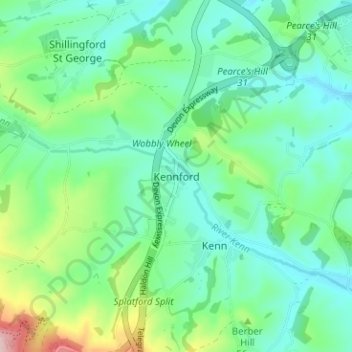
Name: Kennford topographic map, elevation, terrain.
Location: Kennford, Teignbridge, Devon, England, EX6 7TT, United Kingdom (50.64649 -3.55544 50.68649 -3.51544)
Average elevation: 223 ft
Minimum elevation: 43 ft
Maximum elevation: 768 ft
Thank you for supporting this site ❤️
Make a donation
Make a donation
Gear up for your next adventure:
As an Amazon Associate, this site earns from qualifying purchases at no extra cost to you.