
Sequeiros topographic map
Interactive map
Click on the map to display elevation.
About this map
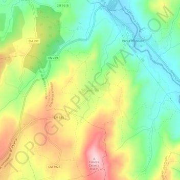
Name: Sequeiros topographic map, elevation, terrain.
Location: Sequeiros, Aguiar da Beira, Guarda, 3570-191, Portugal (40.81907 -7.52957 40.85907 -7.48957)
Average elevation: 2,310 ft
Minimum elevation: 1,962 ft
Maximum elevation: 2,785 ft
Other topographic maps
Click on a map to view its topography, its elevation and its terrain.
Valverde
Portugal > Guarda > Aguiar da Beira
Valverde, Aguiar da Beira, Guarda, 3570-000, Portugal
Average elevation: 2,313 ft