
Valverde topographic map
Interactive map
Click on the map to display elevation.
About this map
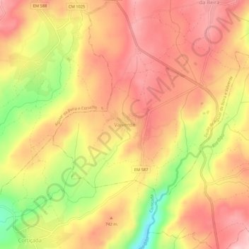
Name: Valverde topographic map, elevation, terrain.
Location: Valverde, Aguiar da Beira, Guarda, 3570-000, Portugal (40.76334 -7.54190 40.80334 -7.50190)
Average elevation: 2,313 ft
Minimum elevation: 1,883 ft
Maximum elevation: 2,566 ft
Other topographic maps
Click on a map to view its topography, its elevation and its terrain.
Sequeiros
Portugal > Guarda > Aguiar da Beira
Sequeiros, Aguiar da Beira, Guarda, 3570-191, Portugal
Average elevation: 2,310 ft