
Make a donation
Gear up for your next adventure:
As an Amazon Associate, this site earns from qualifying purchases at no extra cost to you.
Pinetown topographic map
Click on the map to display elevation.
Make a donation
Gear up for your next adventure:
As an Amazon Associate, this site earns from qualifying purchases at no extra cost to you.
About this map
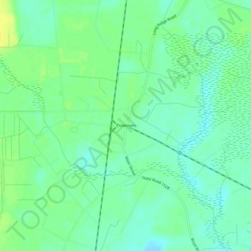
Name: Pinetown topographic map, elevation, terrain.
Location: Pinetown, Beaufort County, North Carolina, United States (35.59044 -76.88133 35.63044 -76.84133)
Average elevation: 39 ft
Minimum elevation: 10 ft
Maximum elevation: 79 ft
Beaufort County trails, hiking, mountain biking, running and outdoor activities
Make a donation
Gear up for your next adventure:
As an Amazon Associate, this site earns from qualifying purchases at no extra cost to you.
Other topographic maps
Click on a map to view its topography, its elevation and its terrain.
City of Washington
United States > North Carolina > Beaufort County > City of Washington
Average elevation: 26 ft