
Thank you for supporting this site ❤️
Make a donation
Make a donation
Gear up for your next adventure:
As an Amazon Associate, this site earns from qualifying purchases at no extra cost to you.
Huaytara topographic map
Click on the map to display elevation.
Thank you for supporting this site ❤️
Make a donation
Make a donation
Gear up for your next adventure:
As an Amazon Associate, this site earns from qualifying purchases at no extra cost to you.
About this map
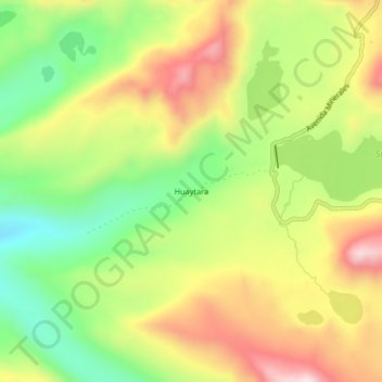
Name: Huaytara topographic map, elevation, terrain.
Location: Huaytara, José María Arguedas, Andahuaylas, Apurímac, Perú (-13.84945 -73.31508 -13.80945 -73.27508)
Average elevation: 14,022 ft
Minimum elevation: 13,307 ft
Maximum elevation: 14,816 ft
Thank you for supporting this site ❤️
Make a donation
Make a donation
Gear up for your next adventure:
As an Amazon Associate, this site earns from qualifying purchases at no extra cost to you.