
Make a donation
Gear up for your next adventure:
As an Amazon Associate, this site earns from qualifying purchases at no extra cost to you.
Kreiel topographic map
Click on the map to display elevation.
Make a donation
Gear up for your next adventure:
As an Amazon Associate, this site earns from qualifying purchases at no extra cost to you.
About this map
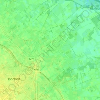
Name: Kreiel topographic map, elevation, terrain.
Location: Kreiel, Bocholt, Maaseik, Limburg, 3950, België (51.16452 5.58060 51.20452 5.62060)
Average elevation: 125 ft
Minimum elevation: 95 ft
Maximum elevation: 151 ft
Make a donation
Gear up for your next adventure:
As an Amazon Associate, this site earns from qualifying purchases at no extra cost to you.
Other topographic maps
Click on a map to view its topography, its elevation and its terrain.
Reppel
België > Limburg > Maaseik > Bocholt
Op de Bergerheide is turf gestoken. Hier zou een treintje met kiepwagentjes gelopen hebben. De hoogte achter de voetbalvelden is een overblijfsel van de turfwinning. Het vroegere natte hoogveen is afgegraven voor de turf. Daarna werd hier veelal naaldbos geplant voor de productie van mijnhout.
Average elevation: 171 ft