
Thank you for supporting this site ❤️
Make a donation
Make a donation
Gear up for your next adventure:
As an Amazon Associate, this site earns from qualifying purchases at no extra cost to you.
Valbom topographic map
Click on the map to display elevation.
Thank you for supporting this site ❤️
Make a donation
Make a donation
Gear up for your next adventure:
As an Amazon Associate, this site earns from qualifying purchases at no extra cost to you.
About this map
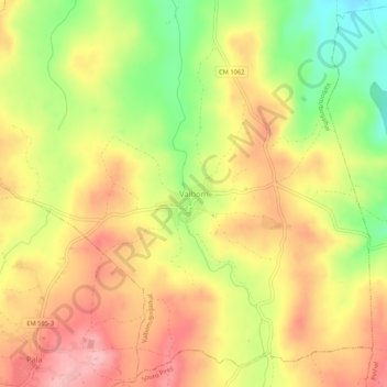
Name: Valbom topographic map, elevation, terrain.
Location: Valbom, Valbom/Bogalhal, Pinhel, Guarda, 6400-376, Portugal (40.76182 -7.14803 40.80182 -7.10803)
Average elevation: 1,982 ft
Minimum elevation: 1,709 ft
Maximum elevation: 2,188 ft
Thank you for supporting this site ❤️
Make a donation
Make a donation
Gear up for your next adventure:
As an Amazon Associate, this site earns from qualifying purchases at no extra cost to you.