Geolocate

Col de la Forclaz topographic map

Click on the map to display elevation.

About this map
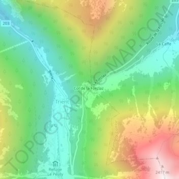
Name: Col de la Forclaz topographic map, elevation, terrain.

Location: Col de la Forclaz, Trient, Martigny, Wallis, 1929, Switzerland (46.05767 7.00130 46.05777 7.00140)

Average elevation: 5,371 ft

Minimum elevation: 3,891 ft

Maximum elevation: 7,982 ft

Gear up for your next adventure:

🛡️Bear Spray Outdoor - Protection in bear country hikes
💧Water Filtration Bottles - Safely drink from streams and lakes while exploring
🖼️Topo Map Wall Art - Decorative topographic prints of famous peaks and regions
🪶Thermal Camp Blanket - Extra warmth for cold nights
🗻Climbing Gear Basics - Essential gear for beginner climbers

As an Amazon Associate, this site earns from qualifying purchases at no extra cost to you.