Geolocate

Archoo topographic map

Click on the map to display elevation.

About this map

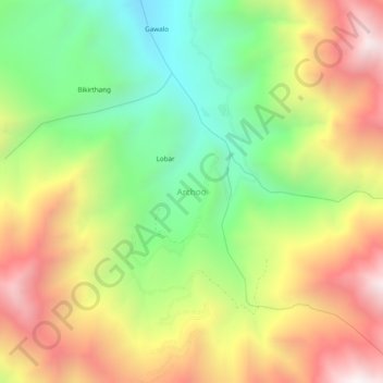
Name: Archoo topographic map, elevation, terrain.

Location: Archoo, Sankoo tehsil, Ladakh, India (34.41797 76.10675 34.45797 76.14675)

Average elevation: 12,743 ft

Minimum elevation: 10,745 ft

Maximum elevation: 15,066 ft

Gear up for your next adventure:

🛌Ultralight Sleeping Bags - Compact down bags for cold nights in the wilderness
🔌Solar Panel Charger - Charge gear sustainably outdoors
🧢Outdoor Hiking Hat - Sun protection hat for outdoor explorers
🛠️Outdoor Gear Repair Kit - Essential tools to fix gear on the trail
📶Vehicle Signal Boosters - Improve reception in rural areas while driving to trailheads

As an Amazon Associate, this site earns from qualifying purchases at no extra cost to you.