Geolocate

Durham topographic map

Click on the map to display elevation.

About this map

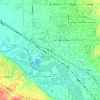
Name: Durham topographic map, elevation, terrain.

Location: Durham, Grand Junction, Mesa County, Colorado, 81505, United States (39.06793 -108.61902 39.10793 -108.57902)

Average elevation: 4,573 ft

Minimum elevation: 4,498 ft

Maximum elevation: 4,764 ft

Other topographic maps

Click on a map to view its topography, its elevation and its terrain.

Gear up for your next adventure:

🚑Emergency Bivvies - Heat-reflective sleeping bags for survival situations
🎁Geography Themed Gifts - Unique gift ideas for map lovers and geography enthusiasts
🧯Portable Fire Pit - Compact fire pit for camping spots
📖Nature Tracking Books - Learn to track wildlife and terrain
🖼️Topo Map Wall Art - Decorative topographic prints of famous peaks and regions

As an Amazon Associate, this site earns from qualifying purchases at no extra cost to you.