
Labata topographic map
Interactive map
Click on the map to display elevation.
About this map
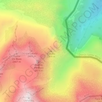
Name: Labata topographic map, elevation, terrain.
Location: Labata, Ansó, La Jacetania, Huesca, Aragón, 22889, España (42.78225 -0.57617 42.78235 -0.57607)
Average elevation: 6,522 ft
Minimum elevation: 4,380 ft
Maximum elevation: 8,340 ft
Other topographic maps
Click on a map to view its topography, its elevation and its terrain.
Ibon de Estanés
Ibon de Estanés, GR11 - Senda de Camille, Ansó, La Jacetania, Huesca, Aragón, España
Average elevation: 5,978 ft