
Kaneohe topographic map
Click on the map to display elevation.
About this map
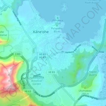
Name: Kaneohe topographic map, elevation, terrain.
Location: Kaneohe, Honolulu County, Hawaii, 96744, United States (21.37929 -157.83038 21.43143 -157.76012)
Average elevation: 344 ft
Minimum elevation: -7 ft
Maximum elevation: 2,749 ft
Honolulu County trails, hiking, mountain biking, running and outdoor activities
Other topographic maps
Click on a map to view its topography, its elevation and its terrain.