Geolocate

Picher topographic map

Click on the map to display elevation.

About this map

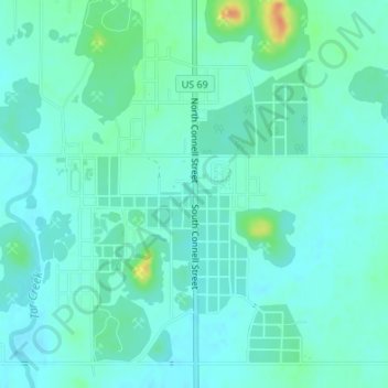
Name: Picher topographic map, elevation, terrain.

Location: Picher, Ottawa County, Oklahoma, 74360, United States (36.97438 -94.84108 36.99438 -94.82108)

Average elevation: 830 ft

Minimum elevation: 801 ft

Maximum elevation: 942 ft

Ottawa County trails, hiking, mountain biking, running and outdoor activities

Other topographic maps

Click on a map to view its topography, its elevation and its terrain.

Afton

United States > Oklahoma > Ottawa County

Average elevation: 794 ft

Miami

United States > Oklahoma > Ottawa County

Average elevation: 791 ft

Wyandotte

United States > Oklahoma > Ottawa County

Average elevation: 787 ft

North Miami

United States > Oklahoma > Ottawa County

Average elevation: 801 ft

Narcissa

United States > Oklahoma > Ottawa County > Narcissa

Average elevation: 820 ft

Fairland

United States > Oklahoma > Ottawa County

Average elevation: 823 ft

Miami

United States > Oklahoma > Ottawa County

Average elevation: 791 ft

Gear up for your next adventure:

🛏️Cold Weather Sleeping Bag - Warm sleeping bag for cold conditions
🔌Solar Panel Charger - Charge gear sustainably outdoors
🗺️Topographic Maps - Detailed topo maps for hiking, exploring and outdoor navigation
📶Satellite Messenger - Communication device off‑grid
🎒Hydration Pack - Hands‑free water reservoir for long hikes

As an Amazon Associate, this site earns from qualifying purchases at no extra cost to you.